| Introduction - Benin: |
| Country | Benin |
|
|
|
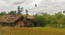
| Background | Present day Benin was the site of Dahomey, a prominent West African kingdom that rose in the 15th century. The territory became a French Colony in 1872 and achieved independence on 1 August 1960, as the Republic of Benin. A succession of military governments ended in 1972 with the rise to power of Mathieu KEREKOU and the establishment of a government based on Marxist-Leninist principles. A move to representative government began in 1989. Two years later, free elections ushered in former Prime Minister Nicephore SOGLO as president, marking the first successful transfer of power in Africa from a dictatorship to a democracy. KEREKOU was returned to power by elections held in 1996 and 2001, though some irregularities were alleged. KEREKOU stepped down at the end of his second term in 2006 and was succeeded by Thomas YAYI Boni, a political outsider and independent. |
|
|
|
| Location - Benin: |
| Location | Western Africa, bordering the Bight of Benin, between Nigeria and Togo |
|
| Geographic coordinates | 9 30 N, 2 15 E |
|
| Map references | Africa |
|
| Area | total: 112,620 sq km
land: 110,620 sq km
water: 2,000 sq km |
|
| Area comparative | slightly smaller than Pennsylvania |
|
| Land boundaries | total: 1,989 km
border countries: Burkina Faso 306 km, Niger 266 km, Nigeria 773 km, Togo 644 km |
|
| Coastline | 121 km |
|
| Maritime claims | territorial sea: 200 nm |
|
| Climate | tropical; hot, humid in south; semiarid in north |
|
| Terrain | mostly flat to undulating plain; some hills and low mountains |
|
| Elevation extremes | lowest point: Atlantic Ocean 0 m
highest point: Mont Sokbaro 658 m |
|
| Natural resources | small offshore oil deposits, limestone, marble, timber |
|
| Land use | arable land: 23.53%
permanent crops: 2.37%
other: 74.1% (2005) |
|
| Irrigated land | 120 sq km (2003) |
|
| Natural hazards | hot, dry, dusty harmattan wind may affect north from December to March |
|
| Environment current issues | inadequate supplies of potable water; poaching threatens wildlife populations; deforestation; desertification |
|
| Environment international agreements | party to: Biodiversity, Climate Change, Climate Change-Kyoto Protocol, Desertification, Endangered Species, Environmental Modification, Hazardous Wastes, Law of the Sea, Ozone Layer Protection, Ship Pollution, Wetlands, Whaling
signed, but not ratified: none of the selected agreements |
|
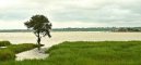
| Geography note | sandbanks create difficult access to a coast with no natural harbors, river mouths, or islands |
|
| People - Benin: |
| Population | 8,078,314
note: estimates for this country explicitly take into account the effects of excess mortality due to AIDS; this can result in lower life expectancy, higher infant mortality and death rates, lower population and growth rates, and changes in the distribution of population by age and sex than would otherwise be expected (July 2007 est.) |
|
| Age structure | 0-14 years: 43.9% (male 1,788,248/female 1,754,940)
15-64 years: 53.7% (male 2,138,649/female 2,203,291)
65 years and over: 2.4% (male 77,844/female 115,342) (2007 est.) |
|
| Median age | total: 17.7 years
male: 17.3 years
female: 18.1 years (2007 est.) |
|
| Population growth rate | 2.674% (2007 est.) |
|
| Birth rate | 38.1 births/1,000 population (2007 est.) |
|
| Death rate | 11.94 deaths/1,000 population (2007 est.) |
|
| Net migration rate | 0.58 migrant(s)/1,000 population (2007 est.) |
|
| Sex ratio | at birth: 1.03 male(s)/female
under 15 years: 1.019 male(s)/female
15-64 years: 0.971 male(s)/female
65 years and over: 0.675 male(s)/female
total population: 0.983 male(s)/female (2007 est.) |
|
| Infant mortality rate | total: 77.85 deaths/1,000 live births
male: 82.32 deaths/1,000 live births
female: 73.26 deaths/1,000 live births (2007 est.) |
|
| Life expectancy at birth | total population: 53.44 years
male: 52.28 years
female: 54.63 years (2007 est.) |
|
| Total fertility rate | 5.08 children born/woman (2007 est.) |
|
| Hiv aids adult prevalence rate | 1.9% (2003 est.) |
|
| Hiv aids people living with hiv aids | 68,000 (2003 est.) |
|
| Hiv aids deaths | 5,800 (2003 est.) |
|
| Nationality | noun: Beninese (singular and plural)
adjective: Beninese |
|
| Major infectious diseases | degree of risk: very high
food or waterborne diseases: bacterial and protozoal diarrhea, hepatitis A, and typhoid fever
vectorborne diseases: malaria, yellow fever, and others are high risks in some locations
respiratory disease: meningococcal meningitis (2007) |
|
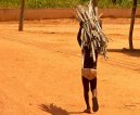
| Ethnic groups | Fon and related 39.2%, Adja and related 15.2%, Yoruba and related 12.3%, Bariba and related 9.2%, Peulh and related 7%, Ottamari and related 6.1%, Yoa-Lokpa and related 4%, Dendi and related 2.5%, other 1.6% (includes Europeans), unspecified 2.9% (2002 census) |
|
| Religions | Christian 42.8% (Catholic 27.1%, Celestial 5%, Methodist 3.2%, other Protestant 2.2%, other 5.3%), Muslim 24.4%, Vodoun 17.3%, other 15.5% (2002 census) |
|
| Languages | French (official), Fon and Yoruba (most common vernaculars in south), tribal languages (at least six major ones in north) |
|
| Literacy | definition: age 15 and over can read and write
total population: 34.7%
male: 47.9%
female: 23.3% (2002 census) |
|
| Government - Benin: |
| Country name | conventional long form: Republic of Benin
conventional short form: Benin
local long form: Republique du Benin
local short form: Benin
former: Dahomey |
|
| Government type | republic |
|
| Capital | name: Porto-Novo (official capital)
geographic coordinates: 6 29 N, 2 37 E
time difference: UTC+1 (6 hours ahead of Washington, DC during Standard Time)
note: Cotonou (seat of government) |
|
| Administrative divisions | 12 departments; Alibori, Atakora, Atlantique, Borgou, Collines, Kouffo, Donga, Littoral, Mono, Oueme, Plateau, Zou |
|
| Independence | 1 August 1960 (from France) |
|
| National holiday | National Day, 1 August (1960) |
|
| Constitution | adopted by referendum 2 December 1990 |
|
| Legal system | based on French civil law and customary law; has not accepted compulsory ICJ jurisdiction |
|
| Suffrage | 18 years of age; universal |
|
| Executive branch | chief of state: President Thomas YAYI Boni (since 6 April 2006); note - the president is both the chief of state and head of government
head of government: President Thomas YAYI Boni (since 6 April 2006)
cabinet: Council of Ministers appointed by the president
elections: president elected by popular vote for a five-year term (eligible for a second term); runoff election held 19 March 2006 (next to be held in March 2011)
election results: Thomas YAYI Boni elected president; percent of vote - Thomas YAYI Boni 74.5%, Adrien HOUNGBEDJI 25.5% |
|
| Legislative branch | unicameral National Assembly or Assemblee Nationale (83 seats; members are elected by direct popular vote to serve four-year terms)
elections: last held 31 March 2007 (next to be held by March 2011)
election results: percent of vote by party - NA; seats by party - FCBE 35, ADD 20, PRD 10, other and independents 18 |
|
| Judicial branch | Constitutional Court or Cour Constitutionnelle; Supreme Court or Cour Supreme; High Court of Justice |
|
| Political parties and leaders | Alliance for Dynamic Democracy or ADD [Nicephore SOGLO]; Alliance of Progress Forces or AFP; African Movement for Democracy and Progress or MADEP [Sefou FAGBOHOUN]; Democratic Renewal Party or PRD [Adrien HOUNGBEDJI]; Force Cowrie for an Emerging Benin or FCBE; Impulse for Progress and Democracy or IPD; Key Force or FC; Movement for Development and Solidarity or MDS; Movement for Development by the Culture-Salute Party-Congress of People for Progress Alliance or Alliance MDC-PS-CPP; New Alliance or NA; Rally for Democracy and Progress or RDP; The Star Alliance (Alliance Etoile) [Sacca LAFIA]; Union of Tomorrows Benin or UBF [Bruno AMOUSSOU]
note: approximately 20 additional minor parties |
|
| Political pressure groups and leaders | NA |
|
| International organization participation | ACCT, ACP, AfDB, AU, ECOWAS, Entente, FAO, FZ, G-77, IAEA, IBRD, ICAO, ICCt, ICRM, IDA, IDB, IFAD, IFC, IFRCS, ILO, IMF, IMO, Interpol, IOC, IOM, IPU, ISO (correspondent), ITSO, ITU, ITUC, MIGA, MONUC, NAM, OIC, OIF, ONUB, OPCW, UN, UNCTAD, UNESCO, UNIDO, UNMIL, UNMIS, UNOCI, UNWTO, UPU, WADB (regional), WAEMU, WCL, WCO, WFTU, WHO, WIPO, WMO, WTO |
|
| Diplomatic representation in the us | chief of mission: Ambassador Cyrille Segbe OGUIN
chancery: 2124 Kalorama Road NW, Washington, DC 20008
telephone: [1] (202) 232-6656
FAX: [1] (202) 265-1996 |
|
| Diplomatic representation from the us | chief of mission: Ambassador Gayleatha B. BROWN
embassy: Rue Caporal Bernard Anani, Cotonou
mailing address: 01 B. P. 2012, Cotonou
telephone: [229] 21-30-06-50
FAX: [229] 21-30-06-70 |
|
| Flag description | two equal horizontal bands of yellow (top) and red (bottom) with a vertical green band on the hoist side |
|
| Economy - Benin: |
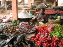
| Economy overview | The economy of Benin remains underdeveloped and dependent on subsistence agriculture, cotton production, and regional trade. Growth in real output has averaged around 5% in the past six years, but rapid population growth has offset much of this increase. Inflation has subsided over the past several years. In order to raise growth still further, Benin plans to attract more foreign investment, place more emphasis on tourism, facilitate the development of new food processing systems and agricultural products, and encourage new information and communication technology. Specific projects to improve the business climate by reforms to the land tenure system, the commercial justice system, and the financial sector were included in Benins $307 million Millennium Challenge Account grant signed in February 2006. The 2001 privatization policy continues in telecommunications, water, electricity, and agriculture in spite of government reluctance. The Paris Club and bilateral creditors have eased the external debt situation, with Benin benefiting from a G8 debt reduction announced in July 2005, while pressing for more rapid structural reforms. Benin continues to be hurt by Nigerian trade protection that bans imports of a growing list of products from Benin and elsewhere, which has resulted in increased smuggling and criminality in the border region. |
|
| Gdp purchasing power parity | $8.989 billion (2006 est.) |
|
| Gdp official exchange rate | $4.622 billion (2006 est.) |
|
| Gdp real growth rate | 4% (2006 est.) |
|
| Gdp per capita ppp | $1,100 (2006 est.) |
|
| Gdp composition by sector | agriculture: 32.8%
industry: 13.7%
services: 53.5% (2006 est.) |
|
| Labor force | 3.211 million (1996) |
|
| Unemployment rate | NA% |
|
| Population below poverty line | 33% (2001 est.) |
|
| Household income or consumption by percentage share | lowest 10%: NA%
highest 10%: NA% |
|
| Inflation rate consumer prices | 3% (2006 est.) |
|
| Investment gross fixed | 19.1% of GDP (2006 est.) |
|
| Budget | revenues: $836.8 million
expenditures: $1.064 billion; including capital expenditures of $NA (2006 est.) |
|
| Agriculture products | cotton, corn, cassava (tapioca), yams, beans, palm oil, peanuts, cashews; livestock |
|
| Industries | textiles, food processing, construction materials, cement |
|
| Industrial production growth rate | 8.3% (2001 est.) |
|
| Electricity production | 82 million kWh (2004) |
|
| Electricity consumption | 576.3 million kWh (2004) |
|
| Electricity exports | 0 kWh (2004) |
|
| Electricity imports | 500 million kWh (2004) |
|
| Oil production | 0 bbl/day (2004) |
|
| Oil consumption | 14,000 bbl/day (2004 est.) |
|
| Oil exports | NA bbl/day |
|
| Oil imports | NA bbl/day |
|
| Oil proved reserves | 8.21 million bbl (1 January 2005) |
|
| Natural gas production | 0 cu m (2004 est.) |
|
| Natural gas consumption | 0 cu m (2004 est.) |
|
| Natural gas proved reserves | 1.133 billion cu m (1 January 2005 est.) |
|
| Current account balance | -$342.7 million (2006 est.) |
|
| Exports | $563.1 million f.o.b. (2006 est.) |
|
| Exports commodities | cotton, cashews, shea butter, textiles, palm products, seafood |
|
| Exports partners | China 21%, Indonesia 7.8%, India 7.1%, Netherlands 6.3%, Niger 5.7%, Togo 4.6%, Nigeria 4.4% (2006) |
|
| Imports | $927.3 million f.o.b. (2006 est.) |
|
| Imports commodities | foodstuffs, capital goods, petroleum products |
|
| Imports partners | China 47.3%, France 7.6%, Thailand 6.1% (2006) |
|
| Reserves of foreign exchange and gold | $607.3 million (2006 est.) |
|
| Debt external | $1.6 billion (2000) |
|
| Economic aid recipient | $342.6 million (2000) |
|
| Currency code | Communaute Financiere Africaine franc (XOF); note - responsible authority is the Central Bank of the West African States |
|
| Exchange rates | Communaute Financiere Africaine francs (XOF) per US dollar - 522.59 (2006), 527.47 (2005), 528.29 (2004), 581.2 (2003), 696.99 (2002) |
|
| Communications - Benin: |
| Fiscal year | calendar year |
|
| Telephones main lines in use | 76,300 (2005) |
|
| Telephones mobile cellular | 750,000 (2005) |
|
| Telephone system | general assessment: NA
domestic: fair system of open-wire, microwave radio relay, and cellular connections
international: country code - 229; satellite earth station - 7 (Intelsat-Atlantic Ocean); fiber optic submarine cable (SAT-3/WASC) provides connectivity to Europe and Asia |
|
| Radio broadcast stations | AM 2, FM 9, shortwave 4 (2000) |
|
| Television broadcast stations | 1 (2001) |
|
| Internet country code | .bj |
|
| Internet hosts | 867 (2006) |
|
| Internet users | 700,000 (2006) |
|
| Transportation - Benin: |
| Airports | 5 (2006) |
|
| Airports with paved runways | total: 1
1,524 to 2,437 m: 1 (2006) |
|
| Airports with unpaved runways | total: 4
2,438 to 3,047 m: 1
1,524 to 2,437 m: 1
914 to 1,523 m: 2 (2006) |
|
| Railways | total: 578 km
narrow gauge: 578 km 1.000-m gauge (2006) |
|
| Roadways | total: 16,000 km
paved: 1,400 km
unpaved: 14,600 km (2005) |
|
| Waterways | 150 km (on River Niger along northern border) (2005) |
|
| Ports and terminals | Cotonou |
|
| Military - Benin: |
| Military branches | Benin Armed Forces: Ground Forces Command, Benin Navy, Benin Peoples Air Force (Force Aerienne Populaire de Benin, FAPB) (2007) |
|
| Military service age and obligation | 21 years of age for compulsory and voluntary military service; in practice, volunteers may be taken at the age of 18; both sexes are eligible for military service; conscript tour of duty - 18 months (2006) |
|
| Manpower available for military service | males age 21-49: 1,295,230
females age 21-49: 1,301,936 (2005 est.) |
|
| Manpower fit for military service | males age 21-49: 749,774
females age 21-49: 751,329 (2005 est.) |
|
| Manpower reaching military service age annually | males age 18-49: 76,661
females: 75,068 (2005 est.) |
|
| Refugees and internally displaced persons | refugees (country of origin): 26,632 (Togo) (2006) |
|
| Military expenditures percent of gdp | 1.7% (2006) |
|
| Disputes international | two villages remain in dispute along the border with Burkina Faso; Benin accused Burkina Faso of moving boundary pillars; much of Benin-Niger boundary, including tripoint with Nigeria, remains undemarcated; in 2005, Nigeria ceded thirteen villages to Benin, but border relations remain strained by rival gang clashes; Benin and Togo announced plans in 2006 to construct a joint hydroelectric dam on the Mona River at the southern end of the border |
|
This page was last updated on 16 September, 2007