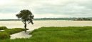
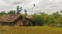
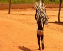
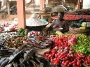
Benin
Benin: Travel tips, articles, photos, gallery, cities database, population, pics, flags, statistics, free maps online
Back to Countries, Click to read the whole article: Benin
| Introduction - Benin: | | Location - Benin: | | People - Benin: | | Government - Benin: | Country name | conventional long form: Republic of Benin
conventional short form: Benin
local long form: Republique du Benin
local short form: Benin
former: Dahomey | | Government type | republic | | Capital | name: Porto-Novo (official capital)
geographic coordinates: 6 29 N, 2 37 E
time difference: UTC+1 (6 hours ahead of Washington, DC during Standard Time)
note: Cotonou (seat of government) | | Administrative divisions | 12 departments; Alibori, Atakora, Atlantique, Borgou, Collines, Kouffo, Donga, Littoral, Mono, Oueme, Plateau, Zou | | Independence | 1 August 1960 (from France) | | National holiday | National Day, 1 August (1960) | | Constitution | adopted by referendum 2 December 1990 | | Legal system | based on French civil law and customary law; has not accepted compulsory ICJ jurisdiction | | Suffrage | 18 years of age; universal | | Executive branch | chief of state: President Thomas YAYI Boni (since 6 April 2006); note - the president is both the chief of state and head of government
head of government: President Thomas YAYI Boni (since 6 April 2006)
cabinet: Council of Ministers appointed by the president
elections: president elected by popular vote for a five-year term (eligible for a second term); runoff election held 19 March 2006 (next to be held in March 2011)
election results: Thomas YAYI Boni elected president; percent of vote - Thomas YAYI Boni 74.5%, Adrien HOUNGBEDJI 25.5% | | Legislative branch | unicameral National Assembly or Assemblee Nationale (83 seats; members are elected by direct popular vote to serve four-year terms)
elections: last held 31 March 2007 (next to be held by March 2011)
election results: percent of vote by party - NA; seats by party - FCBE 35, ADD 20, PRD 10, other and independents 18 | | Judicial branch | Constitutional Court or Cour Constitutionnelle; Supreme Court or Cour Supreme; High Court of Justice | | Political parties and leaders | Alliance for Dynamic Democracy or ADD [Nicephore SOGLO]; Alliance of Progress Forces or AFP; African Movement for Democracy and Progress or MADEP [Sefou FAGBOHOUN]; Democratic Renewal Party or PRD [Adrien HOUNGBEDJI]; Force Cowrie for an Emerging Benin or FCBE; Impulse for Progress and Democracy or IPD; Key Force or FC; Movement for Development and Solidarity or MDS; Movement for Development by the Culture-Salute Party-Congress of People for Progress Alliance or Alliance MDC-PS-CPP; New Alliance or NA; Rally for Democracy and Progress or RDP; The Star Alliance (Alliance Etoile) [Sacca LAFIA]; Union of Tomorrows Benin or UBF [Bruno AMOUSSOU]
note: approximately 20 additional minor parties | | Political pressure groups and leaders | NA | | International organization participation | ACCT, ACP, AfDB, AU, ECOWAS, Entente, FAO, FZ, G-77, IAEA, IBRD, ICAO, ICCt, ICRM, IDA, IDB, IFAD, IFC, IFRCS, ILO, IMF, IMO, Interpol, IOC, IOM, IPU, ISO (correspondent), ITSO, ITU, ITUC, MIGA, MONUC, NAM, OIC, OIF, ONUB, OPCW, UN, UNCTAD, UNESCO, UNIDO, UNMIL, UNMIS, UNOCI, UNWTO, UPU, WADB (regional), WAEMU, WCL, WCO, WFTU, WHO, WIPO, WMO, WTO | | Diplomatic representation in the us | chief of mission: Ambassador Cyrille Segbe OGUIN
chancery: 2124 Kalorama Road NW, Washington, DC 20008
telephone: [1] (202) 232-6656
FAX: [1] (202) 265-1996 | | Diplomatic representation from the us | chief of mission: Ambassador Gayleatha B. BROWN
embassy: Rue Caporal Bernard Anani, Cotonou
mailing address: 01 B. P. 2012, Cotonou
telephone: [229] 21-30-06-50
FAX: [229] 21-30-06-70 | | Flag description | two equal horizontal bands of yellow (top) and red (bottom) with a vertical green band on the hoist side | |
| Economy - Benin: | | Communications - Benin: | | Transportation - Benin: | | Military - Benin: |
This page was last updated on 16 September, 2007
Source: CIA >>> |