| Introduction - Zimbabwe: |
| Country | Zimbabwe |
|
|
|
| Background | The UK annexed Southern Rhodesia from the [British] South Africa Company in 1923. A 1961 constitution was formulated that favored whites in power. In 1965 the government unilaterally declared its independence, but the UK did not recognize the act and demanded more complete voting rights for the black African majority in the country (then called Rhodesia). UN sanctions and a guerrilla uprising finally led to free elections in 1979 and independence (as Zimbabwe) in 1980. Robert MUGABE, the nations first prime minister, has been the countrys only ruler (as president since 1987) and has dominated the countrys political system since independence. His chaotic land redistribution campaign, which began in 2000, caused an exodus of white farmers, crippled the economy, and ushered in widespread shortages of basic commodities. Ignoring international condemnation, MUGABE rigged the 2002 presidential election to ensure his reelection. Opposition and labor strikes in 2003 were unsuccessful in pressuring MUGABE to retire early; security forces continued their brutal repression of regime opponents. The ruling ZANU-PF party used fraud and intimidation to win a two-thirds majority in the March 2005 parliamentary election, allowing it to amend the constitution at will and recreate the Senate, which had been abolished in the late 1980s. In April 2005, Harare embarked on Operation Restore Order, ostensibly an urban rationalization program, which resulted in the destruction of the homes or businesses of 700,000 mostly poor supporters of the opposition, according to UN estimates. ZANU-PF announced in December 2006 that they would seek to extend MUGABEs term in office until 2010 when presidential and parliamentary elections would be harmonized. |
|
|
|
| Location - Zimbabwe: |
| Location | Southern Africa, between South Africa and Zambia |
|
| Geographic coordinates | 20 00 S, 30 00 E |
|
| Map references | Africa |
|
| Area | total: 390,580 sq km
land: 386,670 sq km
water: 3,910 sq km |
|
| Area comparative | slightly larger than Montana |
|
| Land boundaries | total: 3,066 km
border countries: Botswana 813 km, Mozambique 1,231 km, South Africa 225 km, Zambia 797 km |
|
| Coastline | 0 km (landlocked) |
|
| Maritime claims | none (landlocked) |
|
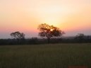
| Climate | tropical; moderated by altitude; rainy season (November to March) |
|
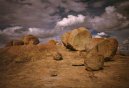
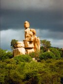
| Terrain | mostly high plateau with higher central plateau (high veld); mountains in east |
|
| Elevation extremes | lowest point: junction of the Runde and Save rivers 162 m
highest point: Inyangani 2,592 m |
|
| Natural resources | coal, chromium ore, asbestos, gold, nickel, copper, iron ore, vanadium, lithium, tin, platinum group metals |
|
| Land use | arable land: 8.24%
permanent crops: 0.33%
other: 91.43% (2005) |
|
| Irrigated land | 1,740 sq km (2003) |
|
| Natural hazards | recurring droughts; floods and severe storms are rare |
|
| Environment current issues | deforestation; soil erosion; land degradation; air and water pollution; the black rhinoceros herd - once the largest concentration of the species in the world - has been significantly reduced by poaching; poor mining practices have led to toxic waste and heavy metal pollution |
|
| Environment international agreements | party to: Biodiversity, Climate Change, Desertification, Endangered Species, Law of the Sea, Ozone Layer Protection
signed, but not ratified: none of the selected agreements |
|
| Geography note | landlocked; the Zambezi forms a natural riverine boundary with Zambia; in full flood (February-April) the massive Victoria Falls on the river forms the worlds largest curtain of falling water |
|
| People - Zimbabwe: |
| Population | 12,311,143
note: estimates for this country explicitly take into account the effects of excess mortality due to AIDS; this can result in lower life expectancy, higher infant mortality and death rates, lower population and growth rates, and changes in the distribution of population by age and sex than would otherwise be expected (July 2007 est.) |
|
| Age structure | 0-14 years: 37.2% (male 2,308,731/female 2,266,027)
15-64 years: 59.3% (male 3,663,108/female 3,641,519)
65 years and over: 3.5% (male 198,867/female 232,891) (2007 est.) |
|
| Median age | total: 20.1 years
male: 19.9 years
female: 20.2 years (2007 est.) |
|
| Population growth rate | 0.595% (2007 est.) |
|
| Birth rate | 27.72 births/1,000 population (2007 est.) |
|
| Death rate | 21.76 deaths/1,000 population (2007 est.) |
|
| Net migration rate | 0 migrant(s)/1,000 population
note: there is an increasing flow of Zimbabweans into South Africa and Botswana in search of better economic opportunities (2007 est.) |
|
| Sex ratio | at birth: 1.03 male(s)/female
under 15 years: 1.019 male(s)/female
15-64 years: 1.006 male(s)/female
65 years and over: 0.854 male(s)/female
total population: 1.005 male(s)/female (2007 est.) |
|
| Infant mortality rate | total: 51.12 deaths/1,000 live births
male: 53.87 deaths/1,000 live births
female: 48.29 deaths/1,000 live births (2007 est.) |
|
| Life expectancy at birth | total population: 39.5 years
male: 40.62 years
female: 38.35 years (2007 est.) |
|
| Total fertility rate | 3.08 children born/woman (2007 est.) |
|
| Hiv aids adult prevalence rate | 24.6% (2001 est.) |
|
| Hiv aids people living with hiv aids | 1.8 million (2001 est.) |
|
| Hiv aids deaths | 170,000 (2003 est.) |
|
| Nationality | noun: Zimbabwean(s)
adjective: Zimbabwean |
|
| Major infectious diseases | degree of risk: high
food or waterborne diseases: bacterial diarrhea, hepatitis A, and typhoid
vectorborne disease: malaria
water contact disease: schistosomiasis (2007) |
|
| Ethnic groups | African 98% (Shona 82%, Ndebele 14%, other 2%), mixed and Asian 1%, white less than 1% |
|
| Religions | syncretic (part Christian, part indigenous beliefs) 50%, Christian 25%, indigenous beliefs 24%, Muslim and other 1% |
|
| Languages | English (official), Shona, Sindebele (the language of the Ndebele, sometimes called Ndebele), numerous but minor tribal dialects |
|
| Literacy | definition: age 15 and over can read and write English
total population: 90.7%
male: 94.2%
female: 87.2% (2003 est.) |
|
| Government - Zimbabwe: |
| Country name | conventional long form: Republic of Zimbabwe
conventional short form: Zimbabwe
former: Southern Rhodesia, Rhodesia |
|
| Government type | parliamentary democracy |
|
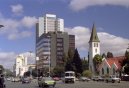
| Capital | name: Harare
geographic coordinates: 17 50 S, 31 03 E
time difference: UTC+2 (7 hours ahead of Washington, DC during Standard Time) |
|
| Administrative divisions | 8 provinces and 2 cities* with provincial status; Bulawayo*, Harare*, Manicaland, Mashonaland Central, Mashonaland East, Mashonaland West, Masvingo, Matabeleland North, Matabeleland South, Midlands |
|
| Independence | 18 April 1980 (from UK) |
|
| National holiday | Independence Day, 18 April (1980) |
|
| Constitution | 21 December 1979 |
|
| Legal system | mixture of Roman-Dutch and English common law |
|
| Suffrage | 18 years of age; universal |
|
| Executive branch | chief of state: Executive President Robert Gabriel MUGABE (since 31 December 1987); Vice President Joseph MSIKA (since December 1999) and Vice President Joyce MUJURU (since 6 December 2004); note - the president is both the chief of state and head of government
head of government: Executive President Robert Gabriel MUGABE (since 31 December 1987); Vice President Joseph MSIKA (since December 1999) and Vice President Joyce MUJURU (since 6 December 2004)
cabinet: Cabinet appointed by the president; responsible to the House of Assembly
elections: presidential candidates nominated with a nomination paper signed by at least 10 registered voters (at least one from each province) and elected by popular vote for a six-year term (no term limits); election last held 9-11 March 2002 (next to be held in March 2008); co-vice presidents appointed by the president
election results: Robert Gabriel MUGABE reelected president; percent of vote - Robert Gabriel MUGABE 56.2%, Morgan TSVANGIRAI 41.9% |
|
| Legislative branch | bicameral Parliament consists of a Senate (66 seats - 50 elected by popular vote for a five-year term, 6 nominated by the president, 10 nominated by the Council of Chiefs) and a House of Assembly (150 seats - 120 elected by popular vote for five-year terms, 12 nominated by the president, 10 occupied by traditional chiefs chosen by their peers, and 8 occupied by provincial governors appointed by the president)
elections: Senate last held 26 November 2005 (next to be held in 2010; House of Assembly last held 31 March 2005 (next to be held in 2010)
election results: Senate - percent of vote by party - ZANU-PF 73.7%, MDC 20.3%, other 4.4%, independents 1.6%; seats by party - ZANU-PF 43, MDC 7; House of Assembly - percent of vote by party - ZANU-PF 59.6%, MDC 39.5%, other 0.9%; seats by party - ZANU-PF 78, MDC 41, independents 1 |
|
| Judicial branch | Supreme Court; High Court |
|
| Political parties and leaders | African National Party or ANP; Movement for Democratic Change or MDC [Morgan TSVANGIRAI, anti-Senate faction; Arthur MUTAMBARA, pro-Senate faction]; Peace Action is Freedom for All or PAFA; United Parties [Abel MUZOREWA]; United Peoples Party [Daniel SHUMBA]; Zimbabwe African National Union-Ndonga or ZANU-Ndonga [Wilson KUMBULA]; Zimbabwe African National Union-Patriotic Front or ZANU-PF [Robert Gabriel MUGABE]; Zimbabwe African Peoples Union or ZAPU [Agrippa MADLELA]; Zimbabwe Youth in Alliance or ZIYA |
|
| Political pressure groups and leaders | Crisis in Zimbabwe Coalition [Arnold TSUNGA]; National Constitutional Assembly or NCA [Lovemore MADHUKU]; Zimbabwe Congress of Trade Unions or ZCTU [Wellington CHIBEBE] |
|
| International organization participation | ACP, AfDB, AU, COMESA, FAO, G-15, G-77, IAEA, IBRD, ICAO, ICCt (signatory), ICRM, IDA, IFAD, IFC, IFRCS, ILO, IMF, IMO, Interpol, IOC, IOM, IPU, ISO, ITSO, ITU, ITUC, MIGA, NAM, OPCW, PCA, SADC, UN, UNCTAD, UNESCO, UNIDO, UNMIS, UNWTO, UPU, WCL, WCO, WFTU, WHO, WIPO, WMO, WTO |
|
| Diplomatic representation in the us | chief of mission: Ambassador Dr. Machivenyika T. MAPURANGA
chancery: 1608 New Hampshire Avenue NW, Washington, DC 20009
telephone: [1] (202) 332-7100
FAX: [1] (202) 483-9326 |
|
| Diplomatic representation from the us | chief of mission: Ambassador Christopher W. DELL
embassy: 172 Herbert Chitepo Avenue, Harare
mailing address: P. O. Box 3340, Harare
telephone: [263] (4) 250-593 and 250-594
FAX: [263] (4) 796-488 |
|
| Flag description | seven equal horizontal bands of green, yellow, red, black, red, yellow, and green with a white isosceles triangle edged in black with its base on the hoist side; a yellow Zimbabwe bird representing the long history of the country is superimposed on a red five-pointed star in the center of the triangle, which symbolizes peace; green symbolizes agriculture, yellow - mineral wealth, red - blood shed to achieve independence, and black stands for the native people |
|
| Economy - Zimbabwe: |
| Economy overview | The government of Zimbabwe faces a wide variety of difficult economic problems as it struggles with an unsustainable fiscal deficit, an overvalued exchange rate, soaring inflation, and bare shelves. Its 1998-2002 involvement in the war in the Democratic Republic of the Congo drained hundreds of millions of dollars from the economy. The governments land reform program, characterized by chaos and violence, has badly damaged the commercial farming sector, the traditional source of exports and foreign exchange and the provider of 400,000 jobs, turning Zimbabwe into a net importer of food products. Badly needed support from the IMF has been suspended because of the governments arrears on past loans, which it began repaying in 2005. The official annual inflation rate rose from 32% in 1998, to 133% in 2004, 585% in 2005, and approached 1000% in 2006, although private sector estimates put the figure much higher. Meanwhile, the official exchange rate fell from approximately 1 (revalued) Zimbabwean dollar per US dollar in 2003 to 160 per US dollar in 2006. |
|
| Gdp purchasing power parity | $25.36 billion (2006 est.) |
|
| Gdp official exchange rate | $3.146 billion (2006 est.) |
|
| Gdp real growth rate | -4.4% (2006 est.) |
|
| Gdp per capita ppp | $2,100 (2006 est.) |
|
| Gdp composition by sector | agriculture: 17.7%
industry: 22.9%
services: 59.4% (2006 est.) |
|
| Labor force | 3.958 million (2006 est.) |
|
| Labor force by occupation | agriculture: 66%
industry: 10%
services: 24% (1996) |
|
| Unemployment rate | 80% (2005 est.) |
|
| Population below poverty line | 80% (2004 est.) |
|
| Household income or consumption by percentage share | lowest 10%: 2%
highest 10%: 40.4% (1995) |
|
| Distribution of family income gini index | 56.8 (2003) |
|
| Inflation rate consumer prices | 976.4% official data; private sector estimates are much higher (2006 est.) |
|
| Investment gross fixed | 16.1% of GDP (2006 est.) |
|
| Budget | revenues: $1.411 billion
expenditures: $1.924 billion; including capital expenditures of $NA (2006 est.) |
|
| Public debt | 108.4% of GDP (2006 est.) |
|
| Agriculture products | corn, cotton, tobacco, wheat, coffee, sugarcane, peanuts; sheep, goats, pigs |
|
| Industries | mining (coal, gold, platinum, copper, nickel, tin, clay, numerous metallic and nonmetallic ores), steel; wood products, cement, chemicals, fertilizer, clothing and footwear, foodstuffs, beverages |
|
| Industrial production growth rate | -1.8% (2006 est.) |
|
| Electricity production | 9.412 billion kWh (2004) |
|
| Electricity consumption | 11 billion kWh (2004) |
|
| Electricity exports | 0 kWh (2004) |
|
| Electricity imports | 2.25 billion kWh (2004) |
|
| Oil production | 0 bbl/day (2004 est.) |
|
| Oil consumption | 22,500 bbl/day (2004 est.) |
|
| Oil exports | 0 bbl/day (2004 est.) |
|
| Oil imports | 13,370 bbl/day (June 26) |
|
| Oil proved reserves | 0 bbl |
|
| Natural gas production | 0 cu m (2004 est.) |
|
| Natural gas consumption | 0 cu m (2004 est.) |
|
| Current account balance | -$264.6 million (2006 est.) |
|
| Exports | $1.766 billion f.o.b. (2006 est.) |
|
| Exports commodities | cotton, tobacco, gold, ferroalloys, textiles/clothing |
|
| Exports partners | South Africa 32.3%, China 6.3%, Zambia 6.2%, Japan 5.9%, US 4.9%, Netherlands 4.6%, Italy 4.4%, Germany 4% (2006) |
|
| Imports | $2.055 billion f.o.b. (2006 est.) |
|
| Imports commodities | machinery and transport equipment, other manufactures, chemicals, fuels |
|
| Imports partners | South Africa 46.1%, China 5.9%, Botswana 4.8%, Zambia 4.1% (2006) |
|
| Reserves of foreign exchange and gold | $140 million (2006 est.) |
|
| Debt external | $5.26 billion (2006 est.) |
|
| Economic aid recipient | $178 million; note - the EU and the US provide food aid on humanitarian grounds (2000 est.) |
|
| Currency code | Zimbabwean dollar (ZWD) |
|
| Exchange rates | Zimbabwean dollars per US dollar - 162.07 (2006), 77.965 (2005), 5.729 (2004), 0.824 (2003), 0.055 (2002)
note: these are official exchange rates; non-official rates vary significantly |
|
| Communications - Zimbabwe: |
| Fiscal year | calendar year |
|
| Telephones main lines in use | 331,700 (2006) |
|
| Telephones mobile cellular | 832,500 (2006) |
|
| Telephone system | general assessment: system was once one of the best in Africa, but now suffers from poor maintenance; more than 100,000 outstanding requests for connection despite an equally large number of installed but unused main lines
domestic: consists of microwave radio relay links, open-wire lines, radiotelephone communication stations, fixed wireless local loop installations, and a substantial mobile cellular network; Internet connection is available in Harare and planned for all major towns and for some of the smaller ones
international: country code - 263; satellite earth stations - 2 Intelsat; 2 international digital gateway exchanges (in Harare and Gweru) |
|
| Radio broadcast stations | AM 7, FM 20 (plus 17 repeater stations), shortwave 1 (1998) |
|
| Television broadcast stations | 16 (1997) |
|
| Internet country code | .zw |
|
| Internet hosts | 7,954 (2006) |
|
| Internet users | 1.22 million (2006) |
|
| Transportation - Zimbabwe: |
| Airports | 403 (2006) |
|
| Airports with paved runways | total: 17
over 3,047 m: 3
2,438 to 3,047 m: 2
1,524 to 2,437 m: 4
914 to 1,523 m: 8 (2006) |
|
| Airports with unpaved runways | total: 386
1,524 to 2,437 m: 5
914 to 1,523 m: 187
under 914 m: 194 (2006) |
|
| Pipelines | refined products 261 km (2006) |
|
| Railways | total: 3,077 km
narrow gauge: 3,077 km 1.067-m gauge (313 km electrified) (2006) |
|
| Roadways | total: 97,440 km
paved: 18,514 km
unpaved: 78,926 km (2002) |
|
| Waterways | on Lake Kariba (2005) |
|
| Ports and terminals | Binga, Kariba |
|
| Military - Zimbabwe: |
| Military branches | Zimbabwe Defense Forces (ZDF): Zimbabwe National Army, Air Force of Zimbabwe (AFZ), Zimbabwe Republic Police (2005) |
|
| Military service age and obligation | 18-24 years of age for compulsory military service; women are eligible to serve (2007) |
|
| Manpower available for military service | males age 18-49: 2,778,404
females age 18-49: 2,681,531 (2005 est.) |
|
| Manpower fit for military service | males age 18-49: 1,304,424
females age 18-49: 1,115,096 (2005 est.) |
|
| Refugees and internally displaced persons | refugees (country of origin): 6,536 (Democratic Republic of Congo)
IDPs: 569,685 (MUGABE-led political violence, human rights violations, land reform, and economic collapse) (2006) |
|
| Military expenditures percent of gdp | 3.8% (2006) |
|
| Disputes international | Botswana built electric fences and South Africa has placed military along the border to stem the flow of thousands of Zimbabweans fleeing to find work and escape political persecution; Namibia has supported, and in 2004 Zimbabwe dropped objections to, plans between Botswana and Zambia to build a bridge over the Zambezi River, thereby de facto recognizing a short, but not clearly delimited, Botswana-Zambia boundary in the river |
|
This page was last updated on 16 September, 2007