| Introduction - Lesotho: |
Country | Lesotho |
|
Background | Basutoland was renamed the Kingdom of Lesotho upon independence from the UK in 1966. The Basuto National Party ruled for the first two decades. King MOSHOESHOE was exiled in 1990, but returned to Lesotho in 1992 and reinstated in 1995. Constitutional government was restored in 1993 after 7 years of military rule. In 1998, violent protests and a military mutiny following a contentious election prompted a brief but bloody intervention by South African and Botswanan military forces under the aegis of the Southern African Development Community. Constitutional reforms have since restored political stability; peaceful parliamentary elections were held in 2002. |
|
|
|
| Location - Lesotho: |
Location | Southern Africa, an enclave of South Africa |
|
Geographic coordinates | 29 30 S, 28 30 E |
|
Map references | Africa |
|
Area | total: 30,355 sq km
land: 30,355 sq km
water: 0 sq km |
|
Area comparative | slightly smaller than Maryland |
|
Land boundaries | total: 909 km
border countries: South Africa 909 km |
|
Coastline | 0 km (landlocked) |
|
Maritime claims | none (landlocked) |
|
Climate | temperate; cool to cold, dry winters; hot, wet summers |
|
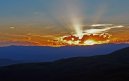
Terrain | mostly highland with plateaus, hills, and mountains |
|
Elevation extremes | lowest point: junction of the Orange and Makhaleng Rivers 1,400 m
highest point: Thabana Ntlenyana 3,482 m |
|
Natural resources | water, agricultural and grazing land, diamonds, sand, clay, building stone |
|
Land use | arable land: 10.87%
permanent crops: 0.13%
other: 89% (2005) |
|
Irrigated land | 30 sq km (2003) |
|
Natural hazards | periodic droughts |
|
Environment current issues | population pressure forcing settlement in marginal areas results in overgrazing, severe soil erosion, and soil exhaustion; desertification; Highlands Water Project controls, stores, and redirects water to South Africa |
|
Environment international agreements | party to: Biodiversity, Climate Change, Climate Change-Kyoto Protocol, Desertification, Endangered Species, Hazardous Wastes, Marine Life Conservation, Ozone Layer Protection, Wetlands
signed, but not ratified: Law of the Sea |
|
Geography note | landlocked, completely surrounded by South Africa; mountainous, more than 80% of the country is 1,800 meters above sea level |
|
| People - Lesotho: |
Population | 2,125,262
note: estimates for this country explicitly take into account the effects of excess mortality due to AIDS; this can result in lower life expectancy, higher infant mortality and death rates, lower population and growth rates, and changes in the distribution of population by age and sex than would otherwise be expected (July 2007 est.) |
|
Age structure | 0-14 years: 35.7% (male 382,308/female 377,303)
15-64 years: 59.3% (male 613,979/female 645,818)
65 years and over: 5% (male 42,621/female 63,233) (2007 est.) |
|
Median age | total: 21.1 years
male: 20.4 years
female: 21.7 years (2007 est.) |
|
Population growth rate | 0.144% (2007 est.) |
|
Birth rate | 24.72 births/1,000 population (2007 est.) |
|
Death rate | 22.49 deaths/1,000 population (2007 est.) |
|
Net migration rate | -0.78 migrant(s)/1,000 population (2007 est.) |
|
Sex ratio | at birth: 1.03 male(s)/female
under 15 years: 1.013 male(s)/female
15-64 years: 0.951 male(s)/female
65 years and over: 0.674 male(s)/female
total population: 0.956 male(s)/female (2007 est.) |
|
Infant mortality rate | total: 79.85 deaths/1,000 live births
male: 84.4 deaths/1,000 live births
female: 75.17 deaths/1,000 live births (2007 est.) |
|
Life expectancy at birth | total population: 39.97 years
male: 40.73 years
female: 39.18 years (2007 est.) |
|
Total fertility rate | 3.21 children born/woman (2007 est.) |
|
Hiv aids adult prevalence rate | 28.9% (2003 est.) |
|
Hiv aids people living with hiv aids | 320,000 (2003 est.) |
|
Hiv aids deaths | 29,000 (2003 est.) |
|
Nationality | noun: Mosotho (singular), Basotho (plural)
adjective: Basotho |
|
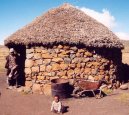
Ethnic groups | Sotho 99.7%, Europeans, Asians, and other 0.3%, |
|
Religions | Christian 80%, indigenous beliefs 20% |
|
Languages | Sesotho (southern Sotho), English (official), Zulu, Xhosa |
|
Literacy | definition: age 15 and over can read and write
total population: 84.8%
male: 74.5%
female: 94.5% (2003 est.) |
|
| Government - Lesotho: |
Country name | conventional long form: Kingdom of Lesotho
conventional short form: Lesotho
local long form: Kingdom of Lesotho
local short form: Lesotho
former: Basutoland |
|
Government type | parliamentary constitutional monarchy |
|
Capital | name: Maseru
geographic coordinates: 29 19 S, 27 29 E
time difference: UTC+2 (7 hours ahead of Washington, DC during Standard Time) |
|
Administrative divisions | 10 districts; Berea, Butha-Buthe, Leribe, Mafeteng, Maseru, Mohales Hoek, Mokhotlong, Qachas Nek, Quthing, Thaba-Tseka |
|
Independence | 4 October 1966 (from UK) |
|
National holiday | Independence Day, 4 October (1966) |
|
Constitution | 2 April 1993 |
|
Legal system | based on English common law and Roman-Dutch law; judicial review of legislative acts in High Court and Court of Appeal; accepts compulsory ICJ jurisdiction with reservations |
|
Suffrage | 18 years of age; universal |
|
Executive branch | chief of state: King LETSIE III (since 7 February 1996); note - King LETSIE III formerly occupied the throne from November 1990 to February 1995 while his father was in exile
head of government: Prime Minister Pakalitha MOSISILI (since 23 May 1998)
cabinet: Cabinet
elections: none - according to the constitution, the leader of the majority party in the Assembly automatically becomes prime minister; the monarch is hereditary, but, under the terms of the constitution, that came into effect after the March 1993 election, the monarch is a living symbol of national unity with no executive or legislative powers; under traditional law the college of chiefs has the power to depose the monarch, determine who is next in the line of succession, or who shall serve as regent in the event that the successor is not of mature age |
|
Legislative branch | bicameral Parliament consists of the Senate (33 members - 22 principal chiefs and 11 other members appointed by the ruling party) and the Assembly (120 seats, 80 by popular vote and 40 by proportional vote; members elected by popular vote for five-year terms)
elections: last held 17 February 2007 (next to be held in 2012)
election results: percent of vote by party - NA; seats by party - LCD 61, NIP 21, ABC 17, LWP 10, ACP 4, BNP 3, other 4 |
|
Judicial branch | High Court (chief justice appointed by the monarch acting on the advice of the Prime Minister); Court of Appeal; Magistrate Courts; customary or traditional court |
|
Political parties and leaders | Alliance of Congress Parties or ACP; All Basotho Convention or ABC [Thomas THABANE]; Basotholand African Congress or BAC [Khauhelo RALITAPOLE]; Basotho Congress Party or BCP [Ntsukunyane MPHANYA]; Basotho National Party or BNP [Maj. Gen. Justin Metsing LEKHANYA]; Kopanang Basotho Party or KPB [Pheelo MOSALA]; Lesotho Congress for Democracy or LCD (the governing party) [Pakalitha MOSISILI]; Lesotho Education Party or LEP [Thabo PITSO]; Lesotho Workers Party or LWP [Macaefa BILLY]; Marematlou Freedom Party or MFP [Vincent MALEBO]; National Independent Party or NIP [Anthony MANYELI]; New Lesotho Freedom Party or NLFP [Manapo MAJARA]; Popular Front for Democracy or PFD [Lekhetho RAKUOANE]; Sefate Democratic Union or SDU [Bofihla NKUEBE]; Social Democratic Party of SDP [Masitise SELESO] |
|
Political pressure groups and leaders | NA |
|
International organization participation | ACP, AfDB, AU, C, FAO, G-77, IBRD, ICAO, ICCt, ICRM, IDA, IFAD, IFC, IFRCS, ILO, IMF, Interpol, IOC, ISO (subscriber), ITU, MIGA, NAM, OPCW, SACU, SADC, UN, UNCTAD, UNESCO, UNHCR, UNIDO, UNWTO, UPU, WCO, WFTU, WHO, WIPO, WMO, WTO |
|
Diplomatic representation in the us | chief of mission: Ambassador Molelekeng E. RAPOLAKI
chancery: 2511 Massachusetts Avenue NW, Washington, DC 20008
telephone: [1] (202) 797-5533 through 5536
FAX: [1] (202) 234-6815 |
|
Diplomatic representation from the us | chief of mission: Ambassador June Carter PERRY
embassy: 254 Kingsway, Maseru West (Consular Section)
mailing address: P. O. Box 333, Maseru 100, Lesotho
telephone: [266] 22 312666
FAX: [266] 22 310116 |
|
Flag description | three horizontal stripes of blue (top), white, and green in the proportions of 3:4:3; the colors represent rain, peace, and prosperity respectively; centered in the white stripe is a black Basotho hat representing the indigenous people; the flag was unfurled in October 2006 to celebrate 40 years of independence |
|
| Economy - Lesotho: |
Economy overview | Small, landlocked, and mountainous, Lesotho relies on remittances from miners employed in South Africa and customs duties from the Southern Africa Customs Union for the majority of government revenue. However, the government has recently strengthened its tax system to reduce dependency on customs duties. Completion of a major hydropower facility in January 1998 now permits the sale of water to South Africa and also generates royalties for Lesotho. Lesotho produces about 90% of its own electrical power needs. As the number of mineworkers has declined steadily over the past several years, a small manufacturing base has developed based on farm products that support the milling, canning, leather, and jute industries, as well as a rapidly expanding apparel-assembly sector. The latter has grown significantly mainly due to Lesotho qualifying for the trade benefits contained in the Africa Growth and Opportunity Act. The economy is still primarily based on subsistence agriculture, especially livestock, although drought has decreased agricultural activity. The extreme inequality in the distribution of income remains a major drawback. Lesotho has signed an Interim Poverty Reduction and Growth Facility with the IMF. |
|
Gdp purchasing power parity | $5.327 billion (2006 est.) |
|
Gdp official exchange rate | $1.437 billion (2006 est.) |
|
Gdp real growth rate | 3% (2006 est.) |
|
Gdp per capita ppp | $2,600 (2006 est.) |
|
Gdp composition by sector | agriculture: 16.1%
industry: 43%
services: 40.9% (2006 est.) |
|
Labor force | 838,000 (2000) |
|
Labor force by occupation | agriculture: 86% of resident population engaged in subsistence agriculture; roughly 35% of the active male wage earners work in South Africa
industry and services: 14% |
|
Unemployment rate | 45% (2002) |
|
Population below poverty line | 49% (1999) |
|
Household income or consumption by percentage share | lowest 10%: 0.9%
highest 10%: 43.4% |
|
Distribution of family income gini index | 63.2 (1995) |
|
Inflation rate consumer prices | 5% (2006 est.) |
|
Investment gross fixed | 32% of GDP (2006 est.) |
|
Budget | revenues: $778.9 million
expenditures: $734.7 million; including capital expenditures of $NA (2006 est.) |
|
Agriculture products | corn, wheat, pulses, sorghum, barley; livestock |
|
Industries | food, beverages, textiles, apparel assembly, handicrafts, construction, tourism |
|
Industrial production growth rate | 15.5% (1999) |
|
Electricity production | 250 million kWh; note - electricity supplied by South Africa (2004) |
|
Electricity consumption | 244.5 million kWh (2004) |
|
Electricity exports | 0 kWh (2004) |
|
Electricity imports | 12 million kWh; note - electricity supplied by South Africa (2004) |
|
Oil production | 0 bbl/day (2004 est.) |
|
Oil consumption | 1,400 bbl/day (2004) |
|
Oil exports | NA bbl/day |
|
Oil imports | NA bbl/day |
|
Oil proved reserves | 0 bbl |
|
Natural gas production | 0 cu m (2004 est.) |
|
Natural gas consumption | 0 cu m (2004 est.) |
|
Current account balance | -$75.44 million (2006 est.) |
|
Exports | $779.1 million f.o.b. (2006 est.) |
|
Exports commodities | manufactures 75% (clothing, footwear, road vehicles), wool and mohair, food and live animals (2000) |
|
Exports partners | Hong Kong 29.6%, China 24%, Taiwan 22.3%, Germany 5.7%, India 5.5% (2006) |
|
Imports | $1.401 billion f.o.b. (2006 est.) |
|
Imports commodities | food; building materials, vehicles, machinery, medicines, petroleum products |
|
Imports partners | US 83.8%, Belgium 12.7%, Canada 2.4% (2006) |
|
Reserves of foreign exchange and gold | $528.2 million (2006 est.) |
|
Debt external | $735 million (2002) |
|
Economic aid recipient | $41.5 million (2000) |
|
Currency code | loti (LSL); South African rand (ZAR) |
|
Exchange rates | maloti per US dollar - 6.85 (2006), 6.3593 (2005), 6.4597 (2004), 7.5648 (2003), 10.541 (2002) |
|
| Communications - Lesotho: |
Fiscal year | 1 April - 31 March |
|
Telephones main lines in use | 48,000 (2005) |
|
Telephones mobile cellular | 249,800 (2005) |
|
Telephone system | general assessment: rudimentary system
domestic: consists of a modest but growing number of landlines, a small microwave radio relay system, and a minor radiotelephone communication system; a cellular mobile telephone system is growing
international: country code - 266; satellite earth station - 1 Intelsat (Atlantic Ocean) |
|
Radio broadcast stations | AM 1, FM 2, shortwave 1 (1998) |
|
Television broadcast stations | 1 (2000) |
|
Internet country code | .ls |
|
Internet hosts | 168 (2006) |
|
Internet users | 51,500 (2005) |
|
| Transportation - Lesotho: |
Airports | 28 (2006) |
|
Airports with paved runways | total: 3
over 3,047 m: 1
914 to 1,523 m: 1
under 914 m: 1 (2006) |
|
Airports with unpaved runways | total: 25
914 to 1,523 m: 4
under 914 m: 21 (2006) |
|
Roadways | total: 5,940 km
paved: 1,087 km
unpaved: 4,853 km (1999) |
|
| Military - Lesotho: |
Military branches | Lesotho Defense Force (LDF): Army and Air Wing |
|
Military service age and obligation | 18 years of age (est.); no conscription (2001) |
|
Manpower available for military service | males age 18-49: 428,982
females age 18-49: 440,102 (2005 est.) |
|
Manpower fit for military service | males age 18-49: 180,797
females age 18-49: 160,681 (2005 est.) |
|
Military note | the Lesotho Government in 1999 began an open debate on the future structure, size, and role of the armed forces, especially considering the Lesotho Defense Forces (LDF) history of intervening in political affairs |
|
Military expenditures percent of gdp | 2.6% (2006) |
|
This page was last updated on 16 September, 2007