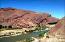
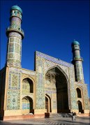
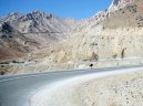
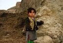
Cities of country: Afghanistan ,region: Helmand
A B C D E F G H I J K L M N O P Q R S T U V W X Y Z
founded: 385cities on K (region Helmand: 1993, country Afghanistan: 48522)| Name | Population | Altitude | Latitude | Longitude |
Khwaja `ali `ulya : |
|
| 30°20'17.2" N | 63°13'49.1" E |
Khwaja Angal : |
| 1 395 m | 32°56'8.2" N | 64°50'57.1" E |
Khwaja `ata Baba : |
|
| 31°35'44.2" N | 64°19'44.0" E |
Khwaja `aziz : |
|
| 32°22'21.0" N | 65°6'29.2" E |
Khwaja Bahauddin : |
|
| 33°6'56.9" N | 65°6'5.0" E |
Khwaja Bedar : |
| 790 m | 31°40'17.0" N | 64°20'28.0" E |
Khwajadad : |
|
| 32°13'7.0" N | 64°49'5.2" E |
Khwaja Garmab : |
| 1 382 m | 32°40'23.9" N | 64°56'12.1" E |
Khwaja Ghaltan : |
| 795 m | 31°43'10.9" N | 64°24'22.0" E |
Khwaja Kawra : |
| 1 557 m | 33°1'54.1" N | 64°55'3.0" E |
Khwaja Lal : |
|
| 32°26'16.1" N | 64°44'12.1" E |
Khwaja Morad : |
| 844 m | 31°52'27.8" N | 64°41'42.0" E |
Khwaja Paksar : |
| 1 032 m | 32°19'59.9" N | 64°55'59.9" E |
Khwaja Zangi Baba : |
| 1 100 m | 32°5'16.1" N | 63°58'46.9" E |
Khwasa Aziz : |
| 1 014 m | 32°22'21.0" N | 65°6'29.2" E |
Kinjak : |
| 1 288 m | 32°28'0.1" N | 64°28'0.1" E |
Kirtaka : |
| 685 m | 30°53'16.1" N | 64°5'21.8" E |
Kishmishkhan : |
| 1 049 m | 32°24'29.9" N | 65°8'21.8" E |
Kocak : |
| 1 018 m | 32°19'48.0" N | 64°59'2.0" E |
Kochai : |
| 975 m | 32°18'7.9" N | 64°58'44.0" E |
Kochonay Khanjak : |
| 975 m | 32°5'7.1" N | 64°40'53.0" E |
Kochonay Khut : |
| 1 493 m | 32°59'35.2" N | 64°46'52.0" E |
Kochonay Kubar : |
| 897 m | 32°9'33.1" N | 64°49'32.2" E |
Koconay Khanjak : |
| 975 m | 32°5'7.1" N | 64°40'53.0" E |
Koconay Kobar : |
| 897 m | 32°9'33.1" N | 64°49'32.2" E |
Kokacel : |
| 973 m | 32°17'13.9" N | 64°59'22.9" E |
Kokochel : |
| 973 m | 32°17'13.9" N | 64°59'22.9" E |
Koli Siah : |
| 1 823 m | 32°28'0.1" N | 64°12'0.0" E |
Kolisyah : |
| 1 823 m | 32°28'0.1" N | 64°12'0.0" E |
Koshk-e Sefid : |
| 1 328 m | 32°18'46.1" N | 63°58'23.9" E |
Koshtay (2) : |
|
| 30°58'17.0" N | 64°10'37.9" E |
Koshtay : |
| 689 m | 30°57'29.2" N | 64°10'5.9" E |
Kotayzay : |
| 911 m | 32°7'34.0" N | 64°54'45.0" E |
Kotey : |
|
| 32°22'17.0" N | 65°4'41.9" E |
Kowkah Chel : |
| 973 m | 32°17'13.9" N | 64°59'22.9" E |
Kowl-e Siah : |
| 1 823 m | 32°28'0.1" N | 64°12'0.0" E |
Kowtayzay : |
| 911 m | 32°7'34.0" N | 64°54'45.0" E |
Kowtey : |
| 1 010 m | 32°22'17.0" N | 65°4'41.9" E |
Ksatta Bajaghar : |
| 988 m | 32°17'8.2" N | 64°58'12.0" E |
Ksatta Geryan : |
| 1 603 m | 32°44'53.9" N | 65°3'29.9" E |
Ksatta Jeljay : |
| 1 035 m | 32°19'5.9" N | 64°52'7.0" E |
Ksatta Talaregh : |
| 1 024 m | 32°19'28.9" N | 64°57'46.1" E |
Kshhatah Ajrum : |
| 1 191 m | 32°8'60.0" N | 64°1'59.9" E |
Ksi2hi2atah Bum (Ks̲h̲atah Bum) : |
|
| 33°9'2.9" N | 65°2'2.0" E |
Ksi2hi2atah Geryan (Ks̲h̲atah Geryan) : |
|
| 32°44'53.9" N | 65°3'29.9" E |
Ksi2hi2atah Malazay (Ks̲h̲atah Malazay) : |
|
| 32°8'25.1" N | 64°55'54.1" E |
Ksi2hi2atah Qeblahtu (Ks̲h̲atah Qeblahtu) : |
|
| 32°57'11.9" N | 64°59'24.0" E |
Ksi2hi2atah Wezdan (Ks̲h̲atah Wezdan) : |
|
| 32°51'19.1" N | 64°51'29.9" E |
Ksi2hi2attah Bajaghar (Ks̲h̲attah Bajaghar) : |
|
| 32°17'8.2" N | 64°58'12.0" E |
Ksi2hi2attah Jeljay (Ks̲h̲attah Jeljay) : |
|
| 32°19'5.9" N | 64°52'7.0" E |
Ksi2hi2attah Talaregh (Ks̲h̲attah Talaregh) : |
|
| 32°19'28.9" N | 64°57'46.1" E |
Ksi„atta-bum (KsĚ„atta-bum) : |
|
| 33°9'2.9" N | 65°2'2.0" E |
Ksi„atta Malazay (KsĚ„atta Malazay) : |
|
| 32°8'25.1" N | 64°55'54.1" E |
Ksi„atta Qeblatu (KsĚ„atta Qeblatu) : |
|
| 32°57'11.9" N | 64°59'24.0" E |
Ksi„atta Wezdan (KsĚ„atta Wezdan) : |
|
| 32°51'19.1" N | 64°51'29.9" E |
Kuchak : |
| 1 018 m | 32°19'48.0" N | 64°59'2.0" E |
Kuchanai : |
| 691 m | 30°58'59.2" N | 64°10'46.9" E |
Kuchkak : |
| 2 047 m | 32°40'0.8" N | 65°11'24.0" E |
Kuchnay Darvishan : |
| 691 m | 30°58'59.2" N | 64°10'46.9" E |
Kuchnay Darweyshan : |
|
| 30°58'59.2" N | 64°10'46.9" E |
Kuchnay Kariz : |
| 1 056 m | 32°6'45.0" N | 65°2'39.8" E |
Kuchnay Regay : |
| 940 m | 32°12'55.1" N | 64°48'7.9" E |
Kuchnay Yaklang : |
| 793 m | 31°39'56.9" N | 64°36'6.1" E |
Kuckak : |
| 1 935 m | 32°40'0.8" N | 65°11'24.0" E |
Kucnay Karez : |
| 872 m | 32°6'45.0" N | 65°2'39.8" E |
Kucnay Khut : |
| 1 493 m | 32°59'35.2" N | 64°46'52.0" E |
Back, View continents ... |
Free IQ test online
An Intelligence Quotient or IQ is a score derived from one of several different standardized tests attempting to measure intelligence. Although the term "IQ" is still in common use, the scoring of modern IQ tests such as the Wechsler Adult Intelligence Scale is now based on a projection of the subject's measured rank on the Gaussian bell curve with a center value (average IQ) of 100, and a standard deviation of 15, although different tests may have different standard deviations. The average IQ scores for many populations have been rising at an average rate of three points per decade since the early 20th century with most of the increase in the lower half of the IQ range: a phenomenon called the Flynn effect. It is disputed whether these changes in scores reflect real changes in intellectual abilities, or merely methodological problems with past or present testing. (Wikipedie)
IQ test lasts approximately 30 minutes and contains 40 questions !
In the IQ test you must focus on the maximum. Test questions are simple. In the IQ test may not use the calculator and paper.
Free IQ test online :
Banner on your page · Visitor's book · Besplatnye igry onlajn · Free games online · CZ Hry · RoboStav
Copyright (c) 2024 by TiptopGlobe.com. All Rights Reserved!